We do Topography Survey faster and accurate
TOPOGRAPHICAL SURVEYS
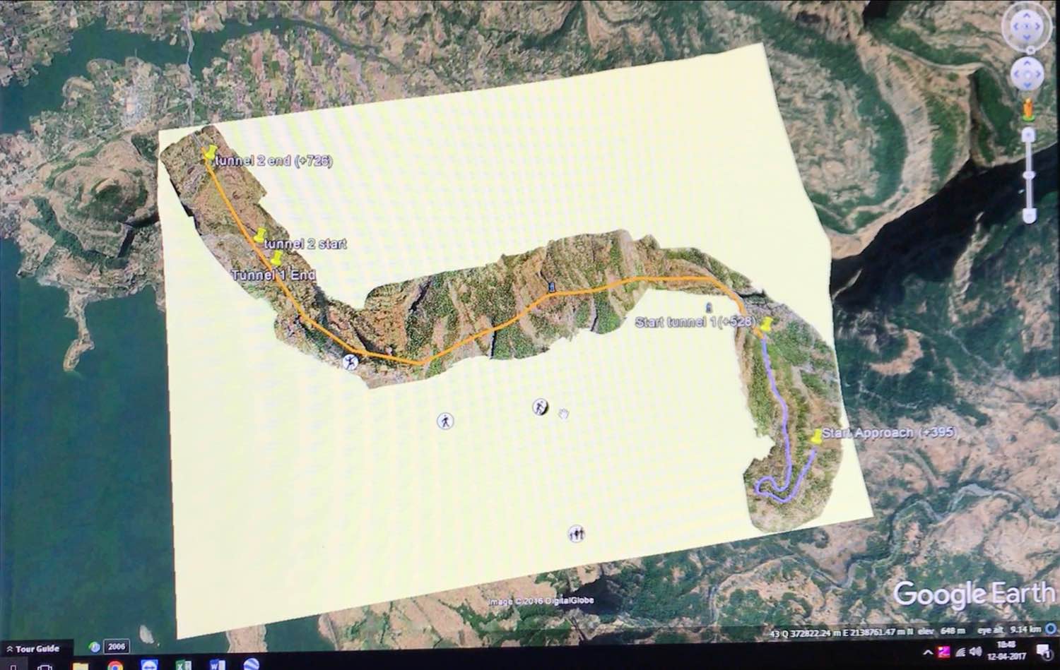
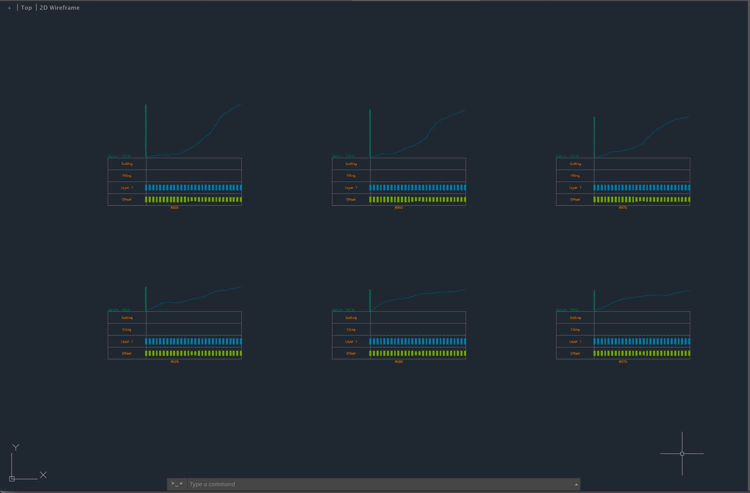
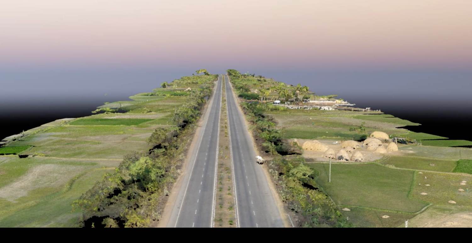
We provide spectrum of outputs obtained by Photogrammetry – Contours Survey, Cross sections at required interval and offset, L Section, CSV File (Northing, Easting and Elevation), High Resolution Road Images with Chainages, ROW, Centre Line marked on it, Structures & Utility Inventory Survey, Tree Mapping and Survey, Existing Land Use Survey, Village Map Superimposing, Control Points marking and Traversing, Aerial Survey for Metro, KML/KMZ data, Profile Plan (Features Mapping)
PROJECT MONITORING
Aerial Photography & Videography for Project Monitoring
AGRICULTURAL SOLUTIONS
Crop Identification, Assessment and Measurement, Village Map Superimposing
AERIAL VIDEOGRAPHY/ 3D MODELING
3D Videos obtained from Photogrammetry, 3D Oblique Photography and Modeling
ELU

Profile Plan

Row Marking

Contours

KMZ
Cross section
3d video
L Section

Town Planning
